
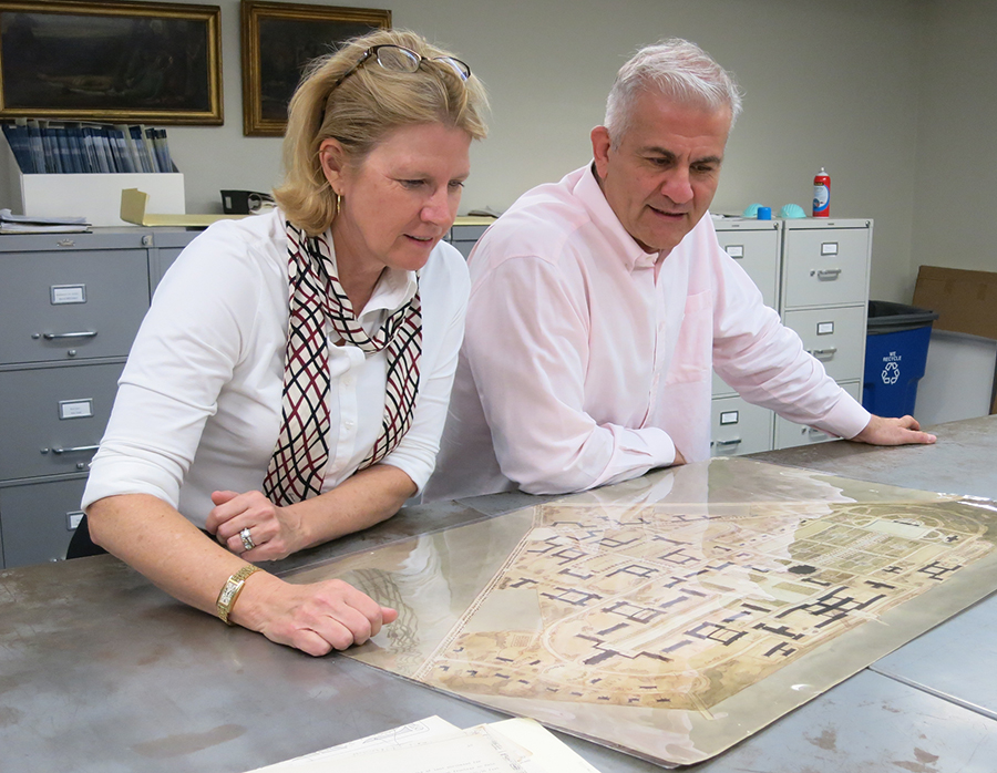
Melissa Kean and Fares el-Dahdah review a campus map from the Woodson Research Center archives.
“Imagine an interactive map, that draws itself on the fly and that changes over time or across the data you select,” muses Farès el-Dahdah, Rice University Professor and Director of the Humanities Research Center. More specifically, what if you could watch a gradually changing map of the Rice University campus as it evolves over time? By combining multiple technologies and databases, el-Dahdah is creating that map with the help of Melissa Kean (University Historian) and Christian Hauser (undergraduate student).
The interactive map project tracks Rice’s actual physical footprint as well as how it might have looked, based on visions of the campus created throughout its history. The idea for the map was triggered by a similar project el-Dahdah is creating with Alida Metcalf, Department Chair and Harris Masterson Jr. Professor of History, both of whom brainstormed methods to capture the development of Rio de Janeiro across several centuries. “We invented a project without data,” said el-Dahdah with a smile. “We hired a digital cartographer when we had almost no data. Then there were storage and server issues – how would we archive the files we collected and where would the server be located, who would own and maintain the equipment for an ongoing project that can grow as resources are continually added decades into the future?”
While el-Dahdah and Metcalf were struggling with technologies to launch the Rio map, ideas for a local application inspired the possibility of a Rice geomapping project. “Think about how one might build a database that integrates geographical and visual data,” said el-Dahdah. “The project’s visual library could draw on the rich resources available at the Woodson Center.” Architectural drawings can also be used and are familiar to el-Dahdah, who spent 20 years as a professor in the School of Architecture before accepting the director’s role for the Humanities Research Center.
Working on the Rio and Rice projects simultaneously helped el-Dahdah organize tasks more efficiently. “The Rio project provided wisdom, knowing how to do it and in what sequence,” said el-Dahdah. “so that in the Rice project we now knew when to tackle each phase, and when to work with a cartographer.” The Rice project, in turn, made it necessary to resolve technology issues locally. Learning how to set up servers on campus, how and where to store data files, and how to work with databases on a local level at Rice led el-Dahdah to leverage similar technologies for his other map project.
Funding helped break through some of the technology barriers. “Setting up a GIS server on campus involved the hiring of an engineering firm and this was possible thanks to an ERIT grant made available to us through K2I.” ERIT (Enriching Rice through Information Technology) grants encourage university projects that leverage information technology into research, scholarship and education. ERIT funding helped raise the awareness about such “digital platforms” as el-Dahdah refers to his projects and even paved the way for shared technology partnerships between Fondren Library, the Humanities Research Center, the Chevron Visualization Lab, and the Office of Information Technology. It is perhaps no coincidence that el-Dahdah is currently co-leading a seminar (with Melissa Bailar and Lisa Spiro) titled “Platforms of Knowledge in a Wide Web of Worlds: Production, Participation, and Politics.”
He smiled, remembering a turning point in the project, “Fondren Library’s Digital Media Commons and the GIS/Data Center are my great accomplices, even if it was at times difficult to match what Alida and I had in mind with given standards. For us, an image is not just an image, it can be a map, a view, or an architectural plan. Each type of image is in its own category and will be connected differently to the map. We therefore needed a metadata schema that could not only distinguish between iconographic architectural, and cartographic archives but also provide related geographic information. We needed one space where we could create data that applied to different digital objects in both time and space.”
Explaining the different types of data, el-Dahdah continued, “We have historic maps, aerial views, and architectural plans, many of which were never implemented. But trying to integrate all this data, well we need to work with distinct databases, be they relational, visual, and spatial. We were eventually given a higher level of permissions so that we could change schemas to fit our data and from then on integration among databases became possible.”
Fortunately, el-Dahdah’s previous research experience played a key role in the success of the mapping projects. “I guess it all began when in the School of Architecture I was part of a group that put together a digital archive for historical buildings. Even though I have never been deeply involved in the technology of 1s and 0s, I sort of know how things are organized.” Unknown to el-Dahdah, both technology and technology translation skills would be required to get the mapping projects off the ground. “I ended up learning how to speak different languages,” he said, “to talk with GIS specialists, digital archivists, people who knew SQL, and servers.” And each language had to be spoken appropriately with the right people, people who did not necessarily speak each other’s languages.” He found it was necessary to speak “Metadata, GIS, and postgreSQL for databases and that took a while. Only now do I feel a bit of confidence when for a long time I had no idea about feature classes, attribute tables, and all these things others were throwing around.”
His “ah-hah” moment? “This past summer, I sat in my office for an entire week with Bruno de Castro Sousa, a research assistant who knows GIS. It was the student teaching the teacher and I could see how he made edits, how he wrote his queries, etc.. Then suddenly I could turn around and tell the other research assistant, Christian Hauser, how I wanted things organized in the Rice project. And now, what was once completely opaque becomes not only understandable but simple, really.”
For the moment, the yet to be titled Rice map project concentrates on the first four years of the campus, 1908-1912. “Once designed and well oiled, the machine can work with a few or with many documents,” observed el-Dahdah. “Once we build the map for the first four years, it can then be opened up for additional contributions. The Library will be able to add more data, and hopefully we can continue developing it so that it can act as a portal with Rice alumni who can then contribute visual material of their own that can be mapped out in time and in space.”
Although a great deal of progress has been made, the Rice mapping project web site primarily describes the project. “Look for the map in fall 2016,” smiles el-Dahdah.